“Some random user on Reddit posted a picture claiming that this is the longest straight line path on water possible on the Earth. We implemented a smart algorithm to solve this problem, found the elevation data, ran our algorithm... yes, that random user was right. Also, here's the longest path on land.”
Thanks, I really enjoyed reading it, even though I hoped that they would disprove the original claim!
Edit: here are the gcmap links to the two paths: sea [1], land [2].
They only identify the Reddit user as "kepleronlyknows", but in the Reddit thread [1] he links to his video visualization [2], where his user name is Patrick Anderson.
Before he made the video visualization using Google Earth, he actually went to the library and used a string on a real globe. [3]
There's a longer land path that starts in or near Senegal and ends in China. But they miss it because it goes near the Dead Sea, and they treat anything below sea level as water.
In passing, https://en.wikipedia.org/wiki/Paul_Salopek is walking from Ethiopia to Tierra del Fuego, tracing the path of human migration out of Africa. Walking the coast, not a straight line.
The one they give also crosses numerous rivers and lakes. For the strict version of the challenge where you literally can't cross water it's likely that the best solution is across Antarctica. Guaranteed by temperature to contain no water whatsoever.
I know the globe is unintuitive (it still blows my mind that Muslims in New York City face roughly northeast to point toward Mecca) but it still seems bizarre that the water route can start near the arctic circle, cross the Pacific ocean, nearly touch Antarctica, cross the Atlantic ocean, and cross the Indian ocean to end well north of the equator and still travel only 80% of the way around the globe. This view of the rest of that great circle helped me visualize it: http://www.gcmap.com/mapui?P=58%B037%27N+162%B014%27E-25%B01...
> it still blows my mind that Muslims in New York City face roughly northeast to point toward Mecca
It never occurred to me they would face the shortest distance to Mecca. I've looked it up and apparently it's a point of contention in North America, although the great circle seems to be standard. Interestingly there are landmasses around the antipode of Mecca, which means your direction would vary wildly as you travel around.
If you're in New York and you look due East across the Atlantic, what country are you looking at?
Most people would assume Portugal.
Nope, you're looking (over the curve of the earth, of course), at Morocco. Look just a tiny bit to the south and you're looking at the rest of West Africa. Look Southwest and you're looking at Australia, or even Brazil.
Before I opened the solution, I knew it had to pass through the beagle straight. It is the only choke point separating the largest oceans, about both their empties areas, the far south.
I guess my biggest surprise is that there is a straight line through the Beagle straight.
Beagle Channel is very narrow and has islands both on the north and the south. This path goes thought the Drake Passage that is south of the islands that are south of the Beagle Channel. The Drake Passage is very wide.
Over water, probably something like the entire 60th parallel south.
Over land, I think you want to start near the westernmost point of the African continent and thread the needle of the Isthmus of Suez, and stay south of the Caspian Sea. At least in the projection gcmap.com uses (plate carree - essentially the x-coordinate and y-coordinate are just raw longitude and latitude), this keeps you south of Lake Baikal and allows you to get very far east in far eastern Russia. Something like 17.5 N, 16 W to 69 N, 178.5 E seems to work:
This is different from the Portugal-to-China path that is the longest over land in reality, which a flat-earther would have crossing the Mediterranean.
Yeah, but how do they explain, that the same world looks different, e.g. having different distances and angles depending on the map "type"? This is kind of important for traveling, navigating or measuring the size of the property you own.
They’re flat earthers, they either have no explanation or a completely bogus explanation. Certainly don’t look for any semblance of reason. They just invent whatever to try and feel like they have some secret knowledge.
I'm just curious. I think they still believe to have a consistent worldview themself, as every human does. My question was more regarding their self-understanding and less the kind-of "marketing" they throw at outsiders.
They would tell us we are contradicting ourselves because none of them are straight lines in the traditional sense, if we really believe the Earth is a sphere. Don't underestimate trolls ;-)
If it is undrivable in a straight line, why does that count? I’d assume the longest you could drive in a perfectly straight line would either be the longest straight highway or some drivable desert.
it would be interesting if it was a list of actual journeys with the sub lists of deviations required.
a special club for the brutaly determined and persistant the "strait liners"
things like having to beg, bluff, bribe, your way through someones house
I myself walked the longest path to 1200 karma. It was painful. Blisters of delta_karma=f*vote_points, where f could be 0.5 or 0.3 or unknown lower no. I'm tired, boss.


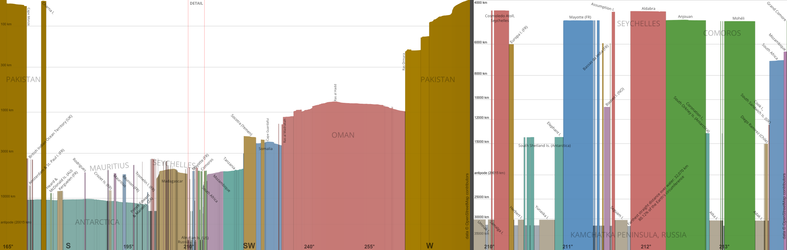
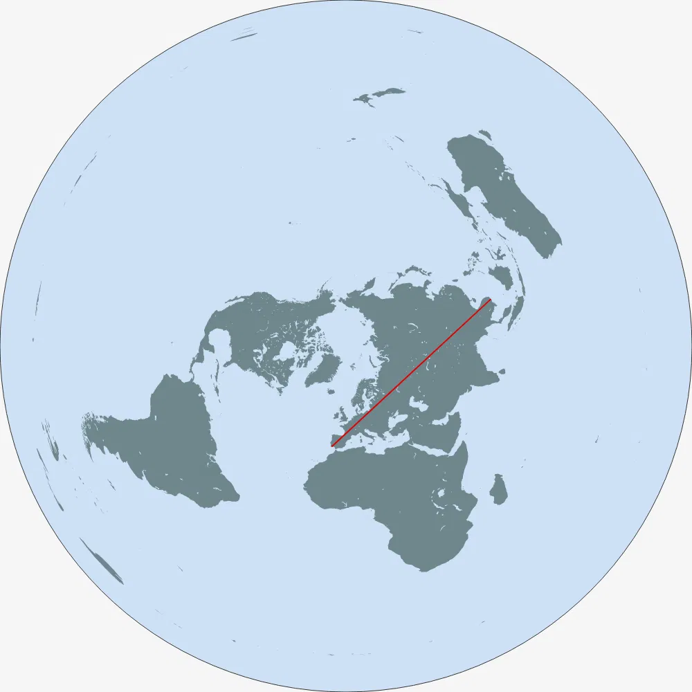
“Some random user on Reddit posted a picture claiming that this is the longest straight line path on water possible on the Earth. We implemented a smart algorithm to solve this problem, found the elevation data, ran our algorithm... yes, that random user was right. Also, here's the longest path on land.”
Thanks, I really enjoyed reading it, even though I hoped that they would disprove the original claim!
Edit: here are the gcmap links to the two paths: sea [1], land [2].
[1]: http://www.gcmap.com/mapui?P=25%B017%27N+66%B040%27E-58%B037...
[2]: http://www.gcmap.com/mapui?P=24%B033%27N+118%B038%27E-37%B02...